
I’ve lived here three years, always looking for new trails to hike and I just recently found out about the Pony Gulch Homestead Trail only a couple miles from my house! It’s not well known and if a few people hadn’t commented on it in the Alltrails app I would have never found it.

Turns out it’s a fairly difficult four mile trek in the remote mountains southwest of Cripple Creek. I was a bit doubtful of the description at first, calling for almost 1000 feet of elevation gain in such a short hike, especially since I know the area and could not imagine a 1000 foot mountain higher than what I can already see. Well, maybe there is a hidden peak back behind that I can’t see I wondered!
Well it didn’t take long to find out the how the elevation gain was going to be accomplished… the very first thing you do once clearing the first ridge is to descend about 750 feet to the bottom of the gulch! Once there you do a bit more climbing to reach the end of trail at the Pony Gulch Homestead in another mile or so.

A dirt road leads to the trailhead, I recommend using the Alltrails GPS directions to find it, where you can see a jeep road heading up a hill leading to the southwest. At the top of the hill you will be able to see a couple of cairns, which is all you are going to see… There is no trail through the first part of the rugged BLM land. Once again, turning on the GPS in your phone to lead you through the first half mile is a good idea. Once into the BLM area about a couple of hundred yards there is a noticeable four wheel drive road which goes the wrong way… don’t take it, veer to the right and look for the gulch. Once you find the gulch there are more cairns and a discernible trail to follow.

The first three quarters of a mile or so is a steep decline down slippery scree in places, my trekking pole got a workout here! There is some nice scenery along this part of the trail, especially in the fall with beautiful golden aspen backed by rugged pine covered cliffs.

Finally at the bottom of the incline the forest opens up to a nice view of the bottom where I imagine a creek flows in the spring. The trail winds down to the dry creek and crosses and earthen dam where the descent ends and a climb begins which takes you another mile to the summit and the Pony Gulch Homestead. The end of the trail is marked by an iron gate marking the entrance to a ranch on private property I presume.
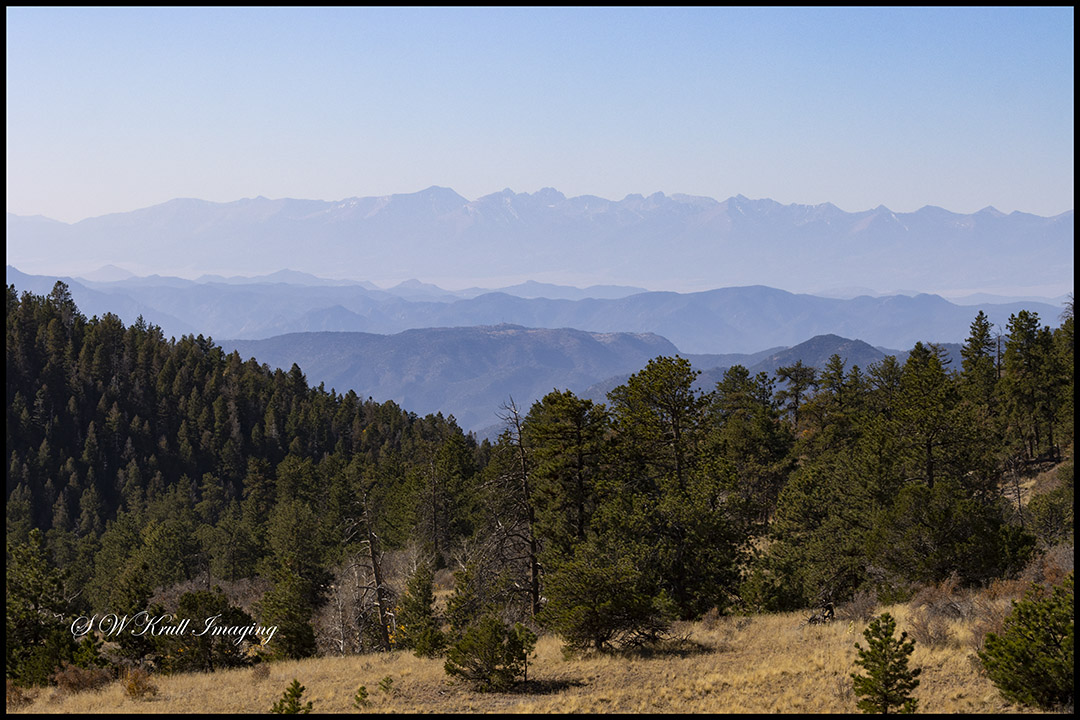
 From there I climbed another hill of mostly big chunks of quartz nearby to get a view of the valley below and also the Sangre de Cristo Range in the background. Unfortunately there wasn’t much to see with all the smoke these days. I Found a nice place to sit and have some food and water and to rest up for the return trip. I put on my 24-105 with a polarizer and took a few pictures to mark the far end of the journey :) I also went down to the homestead to investigate and snap a few more pictures.

Finally the time came to begin the return trip… I checked my GPS to make sure I was headed the right way and it was a good thing I did since there was a forest service road that was more prominent than the actual trail back! A short adjustment in direction and I was on my way. After about a quarter of a mile I came to the southernmost cairn and strode on by… The GPS map showed me straying from the route again on a dotted line that looked like it should be the trail but more careful observation revealed that the cairn marked a left turn down a more faint forest road. So another slight adjustment in direction and I was making the short climb past the high point on the section south of the dam.
Soon I was back to the dam and the mile long climb back up to Lookout Point loomed before me. I have to admit, I took quite a few rest stops to catch my breath on the nearly 1000 foot climb in one mile! Eventually I made my way to the end of the gulch and found myself in search of the cairns that lead the way through the bushwhacking section of the route. Once again, the Alltrails GPS directions come in handy 🙂
I highly recommend this trail to more experienced hikers in a little better physical condition than some. This is not an easy trail and should not be underestimated. I also recommend on this one to let someone know where you are going, it is a very lightly trafficked route and phone signal is iffy at best in the gulch. You might have a long wait for help if you were to twist an ankle or something.
These were my favorite pictures of the dozen or so that I shot along the trail. Please feel free to visit and follow my Instagram page for the rest of my hike plus hundreds more!
For your enjoyment I have also created a library of multimedia videos for my YouTube channel! Feel free to watch and be sure to subscribe to my channel if you would like to see more of my adventures! Also feel free to follow my Instagram page where tons more of my images are displayed!
As always, the best of these images and hundreds more are available for purchase on my website as wall art on glossy metal or acrylic sheets, stretched canvas and traditional matting and framing. Tons of cool household and gift items are also available with any image you like including coffee mugs, t-shirts, blankets and pillows, battery chargers, phone cases, stationary and much much more! Just click on any image you like and all the choices, sizes and prices will appear! For my viewers interested in images for commercial use, please visit my image licensing portal!
Discover more from Colorado Photographer / Author | Steven W. Krull
Subscribe to get the latest posts sent to your email.
