
 Raspberry Mountain turned out to be a bit more rigorous than I expected. The trail profile on Alltrails indicated that it was only going to be about a thousand feet of elevation gain, well within the limits of my training for this hiking season! Well it turns out my app doesn’t really measure the accumulated elevation gain, only the total from the lowest point to the highest point.
The trailhead is located on the Crags Trail Road and is clearly marked just before you get to the Crags Trail parking lot.

The trail begins with a pretty good climb of about 500 feet up some well maintained switchbacks for about a quarter of a mile. From there you hike up and down through the beautiful Pike National Forest for another one and three quarters of a mile to the actual base of Raspberry Mountain where there is a steep climb over slippery scree to a small boulder field at the summit. I have to admit on the way down I did take a nasty spill and I have a couple of spots requiring some aspirin perhaps 😦
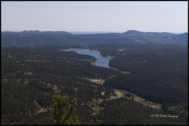
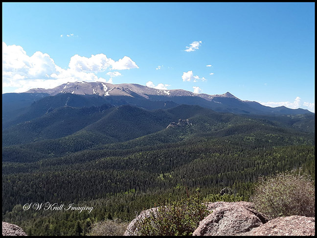
I’m not a fan of boulder fields of any kind but this one was pretty small in comparison to say the one on top of Mount Yale. A small amount of looking for a good route resulted in a pretty easy climb to the summit where there is an awesome near 360 degree view from North Catamount reservoir to the summit of Pikes Peak, the Sangre de Cristo Range to the south and the Mosquito Range to the west.
We lingered at the summit for a bit taking in the view and enjoying some Gatorade before picking our way back down the steep boulder and scree fields. All in all I would say it is a hike well worth doing! Unfortunately we didn’t see much to photograph but this one of North Catamount did turn out pretty nice 🙂
Discover more from Colorado Photographer / Author | Steven W. Krull
Subscribe to get the latest posts sent to your email.
