

Well I finally did it… I drove the length of Gold Camp Road from Victor to Colorado Springs, something I have always wanted to do but never quite worked up the nerve to actually do! I wasn’t planning on it… The plan was to test out the GPS on the phone by driving in a couple of miles to Almagre Mountain and hike a couple miles to the summit for some exercise. The GPS worked splendidly, taking me not a couple of miles, but five miles to a turn off and then three more on a rugged forest road to an unmarked turnout, at which time it told me I had “arrived at my destination”. There were no trail markings, no real hiking trail, just an ugly jeep road heading right up the side of the mountain 😦

Pretty soon another four wheeler pulled up and saw me looking up the mountain and asked me skeptically I might add, if my truck had 4wd. No, I replied… my plan was to hike the short route on foot to the summit. Looking relieved he responded, well it’s about two miles up this jeep road to another jeep road at which time you turn left to another jeep road and it will take you to the summit. Apparently there is another trailhead up yet another jeep road a couple of miles up Gold Camp that is supposed to be shorter but I wasn’t able to locate that route. Having already climbed Grouse Mountain earlier in the day I decided to abandon that plan and head for home…
However once I got back to Gold Camp Road I got to thinking it might be fun to check off that bucket list item and complete the drive down to Colorado Springs. So I turned the old Dodge left and went for broke. Lol… now for my description of Gold Camp Road… It is a stupendously bad washboard riddled, pothole filled, rocky, curvy narrow road traveling through numerous single lane sections between rocky walls that don’t always stay in place and some allegedly haunted tunnels. Several times I had to maneuver around minor cave ins, large rocks in the road and huge holes. My truck was rattling, my teeth were rattling and everything passing by in the other direction was rattling! And that was the good part… when I got closer to the Springs the ride got steeper, rockier, and even more filled with holes!

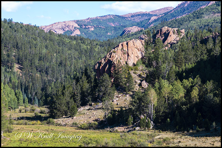
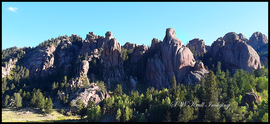
That being said though, the scenery was spectacular, especially the steep part near the Springs. There were a few places where it was possible to look back on the rugged mountains of the Pike National Forest and even though it was mid day by then some of my pictures are kind of nice, at least I think so anyway 🙂 Also the road is lined with aspen groves from end to end so I would highly recommend this route to autumn leaf seekers! I think the colors will be spectacular in late September and early October this year!
Finally I arrived at the end of the dirt road and wound the rest of my way down to the city on the paved portion of Old Stage Road, which I think is what Gold Camp used to be called. According to Westside Pioneer Online, the road has a rich old west history with it’s beginnings as a railway to transport gold ore between Cripple Creek and Midland. Now it popular with four wheelers and ATV enthusiasts and I also saw a few mountain bikers negotiating the steep ascent from Colorado Springs.
Don’t think I’ll need to make that trip again, unless maybe I finally get the jeep that I have been wanting my entire life… but that’s a whole ‘nuther story! As always a couple of these images are available for purchase as wall art and gift items on my website! The traffic and the heat down in the city were horrendous so I think I’ll just sit out the rest of the holiday weekend and wait for the tourists to go home. Next week when the mountains aren’t so crowded I may visit Waterton Canyon again and I have hopes of hiking to Continental Falls near Breck 🙂 Stay tuned!
Discover more from Colorado Photographer / Author | Steven W. Krull
Subscribe to get the latest posts sent to your email.
